
Overview
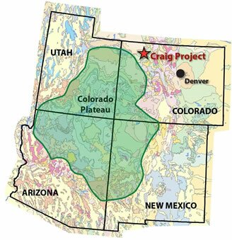 Overlay of Colorado Plateau on map of the four member states.
Click image to see larger version.
More than 170 million tonnes of carbon dioxide are emitted annually from large point sources in Colorado, Utah, New Mexico and Arizona. the Rocky Mountain Carbon Capture and Sequestration (RMCCS) project is characterizing rock formations and related saline formations to assess the potential for safe and permanent storage of these regional CO2 emissions. Mesozoic and Paleozoic rock strata, often buried more than a mile deep, are prime targets for sequestration. The Dakota, Entrada and Weber sandstones are of particular interest. You can learn more about these and other minerals at https://dissertationmasters.com/ where you can find research papers and dissertations, as well as essays for students who want to become geologists.
The three year project consists of surface and subsurface geologic characterizations that will incorporate mapping, seismic data analysis, drilling of a test well, and detailed modeling. A site near the town of Craig Colorado will be the focus of work to assess sequestration potential both locally and regionally.
The Craig site is important locally due to the Craig Station - a 1300 MW coal-burning baseload generation facility. The subsurface rock formations targeted for CO2 injection at this site are also present throughout much of the Rocky Mountains and Colorado Plateau. During the summer of 2010, more than 1,800 structural measurements were collected at the surface to help in modeling geologic structure and behavior in the subsurface.
Previous work by the Colorado Geologic Survey estimated that at 4% efficiency, saline formations in the Weber and Entrada formations would have a capacity of 46.3 billion tons of CO2 in NW Colorado. Regionally this number will be much larger, especially when adding the Dakota Formation as a target.
A strategic test well will be drilled in a structural block in the sand washed basin. The primary targets of analysis are three different layers of porous and permeable sandstone buried deep underground. Each of these deep underground sandstone layers are sealed by nonpermeable continental shales and siltstone. Overlying all of the sandstone beds is the ultimate seal: 5,000 feet of Mancos Shale. The sequestration potential of this formation is difficult to evaluate as few wells penetrate the formation deep enough. The RMCCS project will drill a well deep enough for proper analysis.